Maps and Directions to Newman
As part of our initiative to be a greener campus, we encourage all visitors to travel to Newman by public transport where possible. The following links will help you to plan your journey from your starting point to Birmingham Newman University. These serve as a guide only. Please check your route before leaving home.
Travel by Bus
23: Bartley Green – Woodgate – Harborne – Five Ways – City Centre
The 23 runs from the bus stop outside Newman University via Bartley Green, Romsley Road, Woodgate, Woodgate Valley South, Harborne and Five Ways to the City Centre. The 23 takes passengers to the City Centre via the bus stop across the road from Newman.
More details on route 23 from NXbus.co.uk
X22: Woodgate – Bartley Green – Quinton Road – QE Hospital / University train station – City Centre
Kitwell and Jiggins Lane is served by the X22. This runs from Woodgate via Kitwell, Romsley Road, Bartley Green, Jiggins Lane, California, Quinton Road and University / QE Hospital to Birmingham city centre. Kitwell and Jiggins Lane no longer has direct buses to Harborne, but you can change between the 23 / X22 along Stonehouse Road or California Way.
More details on route X22 from NXbus.co.uk
18: Yardley Wood Bus Garage – Cotteridge – Northfield – Bangham Pit – Bartley Green (change at Northfield for the City Centre bound 61 or 63 bus routes. The X20 route from Northfield goes to University train station).
More details on route 18 from NXBus.co.uk
X21: Bartley Green, Field Lane – Woodcock Hill – Weoley Castle – Selly Oak – QE Hospital / University train station – Birmingham
This service now stops outside Newman
More details on route X21 from NXBus.co.uk
202: Halesowen – Bromsgrove – see details
002: Weoley Castle – Merry Hill via Halesowen – see details
Getting to Newman on the Bus From Nearby Districts
Buses from Birmingham City Centre via Harborne: 23
Buses from Birmingham City Centre via Queen Elizabeth Hospital or University train station: X21, X22
Buses from Halesowen: 202
Buses from Selly Oak: X21
Buses from Yardley Wood via Cotteridge and Northfield: 18
Buses from Merry Hill via Halesowen: 002
Buses from Woodgate: X22
Buses from Kitwell: X22
To travel from West Bromwich catch the 48 and change at Harborne for the 23.
For further information and timetables for these bus services, please visit the Network West Midlands website.
Travel Information from the Local Bus Companies
National Express (please also see their website NXBus.co.uk for any updates)
Diamond Buses (please also see their website diamondbuses.com for any updates)
Travel by Train
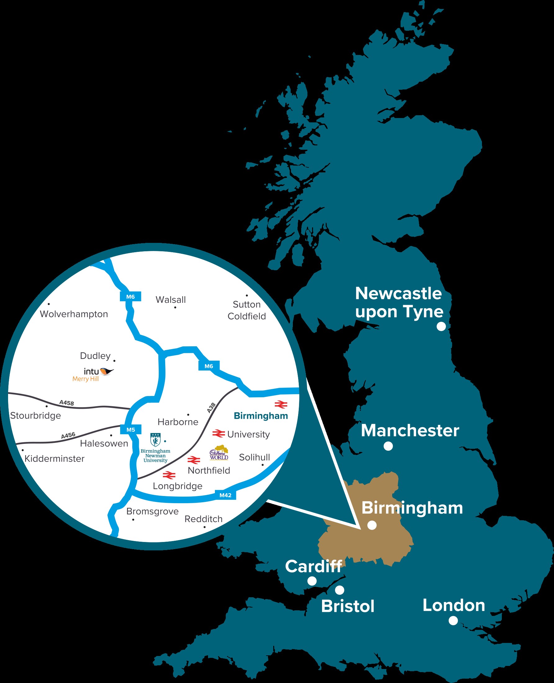
There are a number of railway stations within three miles of Newman. If you are travelling from stations on the Nottingham to Cardiff route or the Birmingham to Hereford route, we recommend taking a direct train to University station and then taking the X22 or X21 bus service (see details above).
If you are travelling from other stations, we recommend changing at Birmingham New Street for Kings Norton station and taking the 18 bus service from directly outside the station. Alternatively, Newman is about 10 minutes by taxi from either University or Kings Norton station.
For information on train operators and times, please consult National Rail Enquiries.
If you’re travelling from London, there are frequent rail services provided by London Northwestern Railway, which will connect you from London Euston to Kings Norton station. For information on times and tickets, as well as other locations to get to us from, see https://www.londonnorthwesternrailway.co.uk/.
For connections to Birmingham from Warwickshire and Staffordshire, as well as major cities like Liverpool, Wolverhampton and Coventry, check https://www.westmidlandsrailway.co.uk/.
Travel by Bicycle or Foot
Further information on cycling routes and walking routes to Newman can be found at the following websites:
Travel by Car

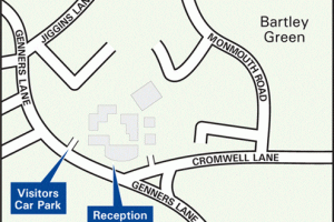
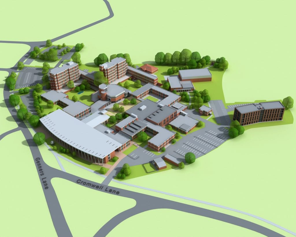
If you are approaching from Adams Hill do not turn left on to Jiggins Lane, but continue past the shops and turn onto the students’ car park for the main entrance and visitors’ car park. If using a GPS/Sat Nav system please enter the co-ordinates: 52.433003,-1.993246 or enter the postcode: B32 3NU.
The visitors car park is accessed through the student car park on Genners Lane.
Overflow car parking is available at Bartley Sailing Club, 101 Genners Lane Bartley Green, Birmingham B32 3NU.
Please note, there is now a Clean Air Zone in Birmingham city centre. Please check before travelling.
Travel by Air
Birmingham International Airport is in the South East of the City with connections world wide. If you are arriving by air we advise that the easiest way of reaching the University is by taxi. The journey time will be about 30 minutes. An alternative route is by rail from Birmingham International Station to New Street and follow instructions above.


